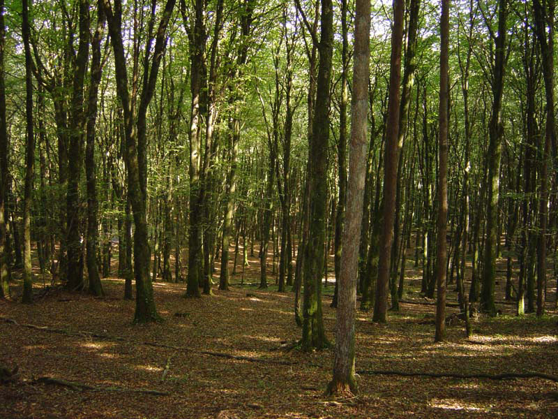
Typical open runnable forest in Mullaghmeen
Directions:
Orienteering events are normally sign posted from Castlepollard
to the South, although it can also be approached from the Oldcastle
to Finea Road on the Northern end. There are numerous
minor roads in the vicinity and it is easy to get lost on the way. Look
out for signs to “Mullaghmeen Country” or head in
the direction of the large forest on the high ground that is visible for
many miles in all directions.
Mullaghmeen is situated on the Meath-Westmeath border,
north of Castlepollard. It is the largest beech plantation in
Ireland, covering approximately 1,000 acres. This large deciduous
forest also contains the highest point in County Westmeath and
is managed on behalf of the state by Coillte. It was originally
planted in the 1940s and the mainly beech trees are still maturing. Small
areas of conifers are being replaced with new hardwoods.
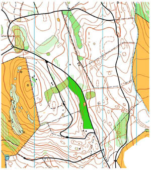
From the high points in the forest there are fines views of the surrounding countryside including Lough Sheelin to the North. There are many smaller hills and areas with complex contour details and together with mature woodland make this ideal orienteering terrain and some would regard it as the finest in Ireland.
A local development company in partnership with Coillte has carried out good work in recent years by developing parking and picnic areas and nature trails. The area is still very much undiscovered by the general public. Those who know it will appreciate the natural beauty, particularly in spring and early summer when primroses and bluebells abound.
Mullaghmeen was first used for orienteering in 1984 when Setanta Orienteers organised the second day of the Irish Two-day Event. Since then it has been used for many major events, including numerous Leinster Championships. Except for a short rest period in the late 1990s and 2000, Mullaghmeen has been used almost continuously for orienteering since 1984. In 2001, following the foot and mouth outbreak, the postponed Leinster Championships event held that September was also the Irish Championships event for that year.
In October 2004 Setanta held a special 20 year anniversary event in Mullaghmeen. The results of this event and the original 1984 event can be found in our results page
You can see some more pictures of Mullaghmeen by selcting the link in the photo gallery